Monday, December 19, 2011

Big Blue Taxi

Vancouver SeaBus
With Vancouver being a port city one would naturally expect that one of the ways for people to get around is by water and, in that regard, the city doesn't disappoint. The transit service provides a SeaBus across Burrard Inlet, there are a couple of private ferry operators in and around False Creek, and water taxis ply other routes between Vancouver Harbour and nearby destinations that have limited or no land access.  All in all, traffic on the water would appear to be a bustling business with a variety of options to choose from.
False Creek ferry photo by Junie Quiroga


The reality unfortunately is something different.  For example the False Creek ferry service is only between a few select locations during the week and the minimum one-way ticket price is $3.25 for a 5-10 minute ride. Other destinations are $4.25 or $6.50 The Aquabus ferry has the same rates but offers a more comprehensive schedule, but the pricing is outrageous when compared to the $2.50 for a single zone TransLink fare.  In the summer, when the tourists have taken over the City, both operators do a roaring trade but come winter it's only the committed commuters who make use of the service.
Aquabus

And without tourists another private company, the English Bay Launch, which provided daily scheduled commuter service between both Coal Harbour and Granville Island to Bowen Island, had to shut down operations for the winter months, leaving its regular customers scrambling for alternate arrangements.  Seems as if the tourists know something the locals don't, namely that the quickest,scenic and most hassle free way of getting around is by water.  Why aren't the locals catching on themselves?

English Bay Launch
One reason may be that folks here just prefer to use their cars in spite of all the problems we have with traffic jams, another might be the scarce number of commuter routes and another might simply be one of scale.  When you look at an aerial view of the Vancouver area you can instantly see the various waterways surrounding the city that include Burrard Inlet in the north, various arms of the Fraser River to the south and English Bay to the west.  Why are there no high speed, purposely designed water craft travelling these waters?

Aerial view of Vancouver
Compare this to Syndey, Australia, where the city is also surrounded by waterways, and how this city takes advantage of its geography to offer an amazing ferry service to 14 million passengers annually. Starting from a centrally located downtown ferry terminal, the service branches out along routes to more than 38 stops within the Inner Harbour, Manly, the Eastern suburbs and the Paramatta River. Vancouver by contrast operates 3 public SeaBus ferries, that only go to one destination.

Aerial view of Sidney
The ferry service in Sydney operates a fleet of  28 vessels ranging in size and speed from the SuperCats carrying approximately 250 passengers at a speed of 22 knots to the 1,100 passenger Freshwater class ships travelling at 15 knots. In Vancouver we have 3 SeaBus vessels (though only 2 are ever in service at any given time) each with a 385 passenger capacity and a speed of 12 knots.

Central Quay in Sidney
Greater Sydney with a population of 4.6 million is exactly double that of Vancouver, with its greater area population of 2.3 million, but that's not enough to account for a more than 10 fold passenger carrying capacity. It owes more to the fact the people got accustomed to a ferry service rather than using the car.  Up until 1932, when the Sydney Harbour Bridge opened, the annual ferry traffic was 30 million passengers.  Vancouver, on the other hand, has always had an ambitious bridge construction policy across its various waterways, which it continues to upgrade and expand upon, and this of course has precluded anything more than a token effort towards the building of a passenger only ferry system.  What Vancouver (British Columbia) does have is the world's largest fleet of vehicle ferries.

Sydney Ferry photo by Junie Quiroga
Vehicle ferries however are a completely different animal and have nothing to do with getting water taxi service in and around the downtown and surrounding suburbs.  How different things might have turned out if there were passenger ferries running along the Fraser River from Pitt Meadows, Langley & Surrey to connecting Skytrain terminals in New Westminster or ferries running along Burrard Inlet from Port Moody, Coquitlam & Burnaby to downtown Vancouver?  Would the lower mainland be a little greener without all the freeways, bridges and traffic?  Would we have saved money in the long run?  Instead of catching a big yellow taxi we might have made a song about riding in a big blue floating taxi.
Newest SeaBus


Monday, November 14, 2011

Blow Wind Blow

Sometimes when the northwest winds howl across Georgia Strait and into English Bay it's just too nasty to go for my morning swim.  The waves that get created once the wind is more than 25 knots are quite strong, and they are often carrying logs and other debris which can make things a little dangerous.  If I'm in the mood to fight my way through the waves for a few hundred metres I can enjoy a bit of an easy body surf back to shore but otherwise it doesn't make for the best swimming conditions.  
English Bay photo by Junie Quiroga
Needless to say gale force winds don't make the best conditions for boaters either, particularly if they are at anchor.  Riding at anchor in English Bay are a number of boats in various states of neglect whose owners cannot find or afford permanent moorage at a marina.  While one of the advantages of anchoring is that it's free it certainly has its disadvantages as well, with the principle one having to be at the mercy of the elements. No matter how well the anchor has been set there's always the risk it may come loose, even the big freighters have been known to pull anchor and drift around, and for small sailboats this is fatal.

Sailboat on Kits Beach photo by Junie Quiroga
Last April a  violent wind storm washed up 3 boats onto Kits Beach and a 4th on the beach near the Maritime Museum.  Since then storms have claimed a few others as well but today 3 more boats ended up on shore with one at Kits Beach, one at the Maritime Museum and another on Sunset Beach.  At a minimum this usually means a boat filled with sand and water and everything inside messed up and broken, but it can also result in severely damaged hulls, rigging and other components. 

Sailboat on Maritime Museum Beach photo by Junie Quiroga
As a fellow boater I can only imagine the heartbreak of an owner finding their boat in this condition.  To add insult to injury there probably isn't any insurance coverage and now expensive arrangements have to be made for the removal and/or repairs.  Owning a boat is always a bit of a financial drain but circumstances like these are particularly upsetting.  The only thing worse would be having this happen while still being on board. 

Sailboat on Sunset Beach photo by Junie Quiroga

There was a time when anyone could indefinitely anchor their boat in the calm and safe waters of False Creek, but this privilege was abused by so many boaters the rules had to be changed.  It wasn't in anyone's interest to have a flotilla of derelict boats littering up the inner harbour. Now boaters are only allowed a 2 week anchoring period and then the boat has to leave.  This allows for visiting boaters to have a place to drop the hook but effectively pushes out the poorer locals who don't want to pay the expensive monthly moorage offered by the marinas. One could argue that if you can't afford to keep a boat perhaps you shouldn't have one and, every time there's a storm and a few more drift onto the beaches, the point becomes even more obvious.

Sunday, October 23, 2011

I'll Be Dog Gone

One of the nice things about the end of summer is that I have the beach all to myself again.  Not too many people are keen to hang around when it's wet of course, or even, for that matter, when it's sunny because it isn't warm anymore.  Without sun and warmth there isn't much point in lying on a beach no matter how much imagination a person may have.  Sunbathing is strictly a summertime activity in Vancouver.  After that it's off to Hawaii or Mexico.

English Bay

But there are some people who still love to go walking in the sand no matter what the season is and perhaps even go for a skinny dip in the ocean as well, even if it might mean breaking the law.  No I'm not referring to some weird cult of west coast naturalists, I'm talking about your best friend and mine, the dogs. And if you haven't been around the west end lately you might be surprised to see how many dogs of all shapes, sizes, and breeds are now living in the land of high rise buildings with no back yards.

Dogs on Seawall photo by Junie Quiroga

Not having a back yard can make it difficult for an owner to deal with a dog's daily routine unless a person is prepared to get up every day at the same time, rain or shine, and take Fido for their morning constitutional; doggy bag in hand of course.  There's usually an evening one as well and then sometime during the day a nice run would also be appreciated.  So how and where does a person fit all this into their schedule and stay within the City rules & regulations?

photo by Junie Quiroga

The walking part isn't bad because, as long as the dog is on a leash, they can walk just about anywhere they want except on designated bathing beaches, of which there are 10 along English Bay from Spanish Banks to Third Beach.  Dogs are also forbidden to be in the water adjacent to a bathing beach.  If they want to go without a leash then they need to visit one of the 33 off-leash areas set aside by the Parks Board or swim in an area not being used by bathers.
Dogs on Seawall photo by Junie Quiroga

Even though I swim every day in the ocean I wouldn't exactly call it bathing, that's something I do when I get back home.  Sunbathing, as we've also discussed, is something that's done for only 4 months of the year at best, so what about the other 8 months?  Does this mean the beaches are open for dogs when there is no bathing of any kind going on?  And what are the bathing hours?  The rules aren't very clear.

Dog on Seawall photo by Junie Quiroga
Where does the bathing beach actually begin?  If it's above the high tide water line, which would keep it consistent with the federal rules on where oceanfront property begins, then how can the City forbid dogs from walking, leashed or not, along the water's edge?  For that matter how can the City regulate who is using the ocean when that's something that falls under federal jurisdiction? And if you accessed the shoreline from a non bathing beach can you keep walking along? Again the rules aren't very clear.

Dog on English Bay photo by Junie Quiroga
I don't own a dog, but personally I don't think there's anything nicer than seeing a dog having a good run along the beach chasing a ball or a frisbee or fetching a stick that's been thrown in the ocean.  The owner's arm usually wears out long before the dog ever does and the dogs are just so happy to get some healthy exercise.  Occasionally a dog will join me in the water as I'm finishing my swim or get curious about a seal that might be lurking nearby but otherwise they really aren't in the ocean all that much.

Dogs playing at English Bay

The fine for not having a dog leashed or being on a bathing beach with your dog is $250.00 and it can go up from there if the dog is impounded or if it doesn't have a license.  Dog owners who take their pets down to the beach in the early morning hours for a walk or a swim may have figured out a few loopholes that keep the enforcement officers away, particularly in the off-season, but it's too bad they have to skulk about like criminals when there are so many other people openly breaking other beach rules. I would much rather see dogs on the beach than the suburban trouble makers, drifters and druggies that hang around always causing a disturbance and not bothering to pick up the trash they leave behind.

Tuesday, October 18, 2011

So Much Shoreline And Not Enough Time

Canada has the longest coastline of any country in the world, with over 200,000 kilometres of mostly uninhabited waterways, deep inlets and island shorelines to patrol.  The Pacific Region alone has more than 25,000 kilometres of coastline that is made up of large fjords, countless small islands, the larger Vancouver Island and Haida Gwaii, and the area along the Washington and Alaska borders. The distance, as the crow flies, from Victoria on the Strait of Juan de Fuca to Prince Rupert near the Alaska panhandle is 806 kilometres.


Of course these waterways make for some of the most fantastic cruising grounds in the world for boaters, especially in summertime, but there are also fishing boats, freighters and smugglers using these same waterways year round when sea conditions and weather often get very nasty. To make sure everyone can get around safely, and to help out those who find themselves in difficulty, is the primary function of the Canadian Coast Guard.  Law enforcement, however, is not their responsibility, which is just as well since they barely have enough equipment, personnel or resources to do their search and rescue work and respond to the more than 3,500 calls they receive each year.


The Coast Guard maintains a fleet of  114 patrol ships, including 4 hovercraft, ranging in size from search and rescue lifeboats to heavy arctic icebreakers, along with 27 rotary and 22 fixed wing aircraft.  While these ships and aircraft are of various age and condition they are all easily recognized by their Canadian flag colours of red and white.  28 of these ships and 2 of the hovercraft, roughly 1/3rd of the fleet, are based out of the 13 stations/bases located in the Pacific Region, with the Sea Island and Kitsilano stations serving the Vancouver area.

Kitsilano Station photo by Junie Quiroga

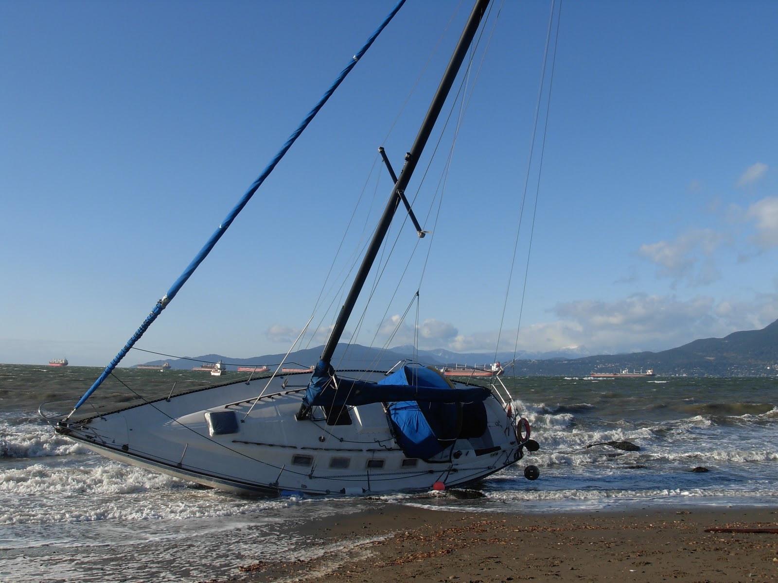
Seemingly always on the move, the near/inshore patrol vessel Osprey and the hovercraft Siyay are commonly sighted as they zoom around the Vancouver Harbour, Georgia Strait, and Howe Sound checking on boaters in distress.  Built in 1998, Siyay is relatively new compared to the Osprey which was built in 1986.  The Osprey belongs to a group of 6 other boats built in the 70's and 80's that are nearing the end of their lifespan and are being replaced by the more modern, self righting, search and rescue (SAR) lifeboats built after the year 2000.

Siyay

Osprey

There are 11 of these SAR lifeboats (with an operating range of 200 kilometres) stationed around the Pacific but there are only 3 mid-shore vessels with a range of more than 2,500 nautical miles to look after all the rest and the newest of those vessels was built in 1991. Even if all these boats were on the move 24 hours a day there would still be a lot of coastline that would never see a Coast Guard vessel from one week to the next.  Fortunately there is also the volunteer Canadian Coast Guard Auxiliary to assist with the coverage model but this group has to rely on donations to cover even the fuel they use.


But an ounce of prevention is worth a pound of cure, and that is why the Coast Guard is also responsible for broadcasting the weather and safety notices, providing marine communications and traffic services, and maintaining the more than 2,000 buoys, lights and beacons that mark the majority of rocks and other hazards along the coastline.  These aids to navigation are indispensible to mariners wanting to know their ship's position and it's a year round effort to keep them all properly serviced and functioning.

Speaking of aids to navigation, I see these pair of bald eagles quite often as I go past the Q41 buoy on my morning swim.  They would make great auxiliary members if only they could use a VHF radio.  Boaters are supposed to keep the buoy on their port side as they come into False Creek and on their starboard side as they leave.  This would protect them from any of the rocks in English Bay and allow me to swim in relative safety.  For the most part boats stay where they belong but it's nice to know there are other folks keeping an eye on things.


There are over 1,000 employees in the Pacific Region trying to do their job in an environment of ever rising fuel costs, old equipment, and pressures to reduce operational expenses.  A daunting task with demands on the service increasing and the need to have a more proactive display of sovereignty in our waters.  Fortunately the federal government has finally realized it needs to up the ante on a neglected service and has commissioned 8 billion dollars worth of new mid-shore vessels, icebreakers and other special use vessels that will be built here in Vancouver over the next few years.

Monday, September 12, 2011

Real Wild Whales

I'm often asked by people if I've ever had any bad experiences in the ocean when I go for my morning swim or if I'm not scared of being attacked by a shark?  My answer is always that the worst thing that's ever happened to me is getting stung by a lion's mane jellyfish, and there aren't any sharks in this part of the world, unless you want to count dogfish, a small, rather harmless member of the shark family measuring about 3 feet which is only rarely encountered by scuba divers.

Spiny dogfish shark
However this past spring I did almost have an encounter with something that would have been rather scary, but I didn't find out about it until I was out of the water and the story was in the news.  This was when a group of 8 transient killer whales made a rare appearance in Vancouver and came cruising along the Stanley Park seawall less than a mile from where I was swimming.  From the photos that were taken it looks like they were more in the mood for playing around than anything else but those aren't the kind of parties you go to uninvited.

photo by Dave Price

photo by Dave Price

It turns out there are 3 different types of killer whales out there, at least in this part of the world.  There are the northern and southern Vancouver Island resident whales who have evolved to the point where they only eat salmon.  There are the transient whales who range up and down the coast from California to Alaska, but occasionally come into the Inside waters of Georgia & Johnstone Straits, and they prey on seals, sea lions, dolphins, porpoises, and young grey and humpback whales.  Finally there are the offshore killer whales, clearly the toughest of them all because they appear to live by only eating sharks. 

Transient Whales photo by Dave Price

Now unless you are someone like the late Michael Bigg, who started the photo identification project that allows for each killer whale to be identified by their unique markings, the average person couldn't tell one killer whale from another.  And with the population of each group somewhere around 250 - 300 that makes for a lot of killer whales to recognize. I feel pretty confident I wouldn't be mistaken for either a salmon or a shark, which takes me off the menu for 2 of the 3 groups, but the 3rd group could be forgiven if they mistook me for a seal as I swim around in my wetsuit, and therein lies the problem.

Resident Whales photos by Junie Quiroga

My wife and I have had the pleasure of being surrounded by resident killer whales in Johnstone Strait as we sat safely in our boat but, even though they were on the hunt for salmon, you sure wouldn't want to get in their way when they are in a feeding frenzy.  When I look at the photos we've taken I can't tell if they are in A, G,or R clan and I certainly can`t tell that one of the transient whales swimming near me this past spring was the infamous Mr. T102.  Really these whales need to invest in some water resistant name tags for everyone`s sake.

Offshore Whales
Apparently the one sign that gives the offshore whales away (other than the different language each of these groups speaks) is they travel in large packs of between 30 - 70 whales.  Good thing they are hundreds of miles offshore or it could get really crowded if they ever showed up.  At least I wouldn`t have to worry about being attacked by a shark.

Monday, June 27, 2011

Come Fly With Me

This month Vancouver's newest airport officially opened and, in keeping with the city's seaside location, it was a float plane terminal rather than a traditional land based airport.  Located in Coal Harbour, with the downtown core and convention centre forming a stunning backdrop, it offers a long overdue facility to service the explosion of travellers preferring to get around by plane instead of using a ferry. Of course this being the Vancouver waterfront nothing was accomplished without all sorts of controversy.

Convention Centre Airport photo by Junie Quiroga

The two main airline companies (Harbour Air and WestCoast Air) are protesting the higher landing/takeoff fees at the new airport and are refusing to move from the old airport.  The old airport was only meant to be a temporary facility and its present location was established over the protests of the local residents. The local residents in turn only got their location after negotiations between the land developers and various waterfront users.


Of course it wasn't always this way.  Before float planes became the choice of businessmen and tourists they were the backbone of the forestry industry.  Coal Harbour was a railway switching yard and the float plane airport was at the Bayshore Hotel where broke loggers would show up to go back to camp while others flush with cash would be disembarking and ready to hit the town. The only thing in common between the old and the new times are the airplanes themselves; particularly the Beaver, the iconic symbol of the Canadian aircraft industry.

Beaver

Designed in 1947 by the de Havilland company as a rugged short take off and landing craft (STOL) for the bush that could be fitted with either wheels, skis or floats, it quickly became the workhorse of the world with over 1,600 manufactured by 1967 when production finally ceased.  However hundreds of Beavers are still in use today and a company in Victoria now has the rights to produce the replacement parts as well as any new airplanes.

Harbour Air plane

While the heydays of logging may be over the spectacular scenery of the west coast will remain forever, and the best way to get around, not to mention the fastest, is by float plane.  Compare a half day of ferry travel with a 40 minute airplane ride for practically the same price and you can see why so many float plane operators have sprung up.  In fact it has even been suggested the float plane may become as synonymous with Vancouver as the trolleys are with San Francisco.
 
West Coast Air plane

The new seaplane airport at the convention centre is bound to increase the float plane traffic which already is up to 55,000 flights per year, the 33rd busiest airport in Canada and the 8th busiest in B.C. In spite of the increased fees this beautiful new facility has to be good news for travellers, aircraft operators and of course the Beaver.

Sunday, May 29, 2011

Row Row Row Your Boat

Rowing has a long and respected history in Vancouver, with the Vancouver Rowing Club itself founded in 1886, the same year as the City, and both entities celebrating their 125th birthday this year.  Pleasantly situated at the entrance to Stanley Park and at the end of Coal Harbour, experienced and novice beginners alike can be seen most afternoons as they carefully and methodically scull (2 oars) or sweep (1 oar) in perfect synchronization either singly, in pairs, fours or eights. The club has produced its share of Commonwealth and Olympic medal winners over the years, and there always seems to be a fresh batch of recruits eager to learn the technique and get some serious exercise in the process.

Vancouver Rowing Club photo by Junie Quiroga
Rowing seems to lend itself readily to racing and, while the actual history of the sport is a little sketchy, we do know the first Oxford Cambridge race took place in 1829 and since then the rivalry between countries, colleges and clubs has never let up.  In the lower mainland alone there are more than 17 official rowing clubs.  While owing to all the boat and airplane traffic the practice area of the Vancouver Rowing Club isn't a practical location for regattas, there's one taking place nearly every weekend somewhere else.


It's not just humans who are fascinated with rowing either.  If you look closely from the seawall you will often see one of the local seals keeping an eye on the rowers.  One seal in particular has been given the name of "coach" because of its habit of popping up around the rowers and seeming to offer advice.  And while I'm swimming in English Bay I often encounter another group of rowers, the False Creek Rowing Club, and their mascot "Ellie" a dog who rides around in the coach's dinghy keeping an eye on things and generally having a great time skimming over the water.


But rowers are only one group of human powered boaters racing in the Vancouver waters, with the paddling community being perhaps the most visible, particularly the Dragon Boaters. Dragon Boat racing has a much more ancient history than rowing, going back 2,000 years in China but was only introduced to Vancouver at the 1986 Expo. Since then it has exploded in popularity with the annual Dragon Boat festival now drawing nearly 200 teams worldwide to compete in a colourful, multicultural event with thousands of spectators ringing the shores of False Creek.


The obvious difference between the rowers and the paddlers is that one group is facing forward and the other is facing backwards as they ply their oars.  As to which method is faster it's hard to say.  A quick review of the Olympic records for paddling a kayak or canoe on a 1,000 metre course is somewhere between 3.5 - 4.0 minutes but, on a 2,000 metre rowing course the times are between 5.5. - 6.5 minutes.


It's a bit like comparing apples to oranges but suffice it to say either method is right up there with the 1,500 metre run which has an Olympic record of approximately 3.5 minutes. Why anyone would need to row or paddle that fast is beyond me unless of course they were being chased by something.

Monday, March 21, 2011

If You're Going To The North Country part 1

In a quiet little corner of Kitsilano sits the Vancouver Maritime Museum, a building overflowing with its collections and artifacts of maritime history and home to the famous R.C.M.P. vessel the St. Roch.  The St. Roch being the first vessel to sail the Northwest Passage from West to East (1940 - 1942) the first vessel to cruise the Northwest Passage in both directions (when it completed an East West journey two years later in a single season) and the first vessel to circumnavigate North America.  Built out of wood and powered by a single 150 hp diesel engine the patrol vessel was originally built in 1928 and stayed in service until 1950.

St. Roch


That the ship would make its final home in Vancouver (where it was originally built) is perhaps more appropriate than most people would realize.  Vancouver after all was named after the famous sea captain who spent 3 seasons from 1792 to 1794 on the HMS Discovery exploring and surveying the rugged B.C. coastline all the way to Alaska in a fruitless search for the Northwest Passage. Each new fjord Vancouver encountered seemed to offer a connecting passage to the North but, as he sailed into them, meticulously mapping every detail along they way, each waterway would prove to be a dead end.

HMS Discovery


Interestingly, these two ships were roughly the same size, Discovery being 99 feet long with a beam of 28 feet and St. Roch being 104 feet long with a 24 foot beam.  But the first ship to complete the Northwest Passage was the Gjoa, in 1906, following an East West route that had taken three winters to complete.  A 70 foot herring fishing boat originally built in 1872, it was converted into a motor-sailor vessel with the addition of a 13 hp motor. The Captain was Roald Amundsen, a Norwegian.  It was another Norwegian, Henry Larsen, who captained the St. Roch, though he had already become a Canadian citizen in 1924.

Gjoa
The fabled Northwest Passage was something people had been seeking since John Cabot tried in 1496 and it wasn't until 1854 that it was proved a route even existed. Robert McClure had been leading an expedition to search for the lost and disastrous Franklin expedition of 1848, when his ship got caught in the ice of Prince of Wales Strait between Banks and Victoria Islands as he was trying for a West East route.  Carrying on by sledge he then discovered Barrow's Strait and the connecting passage, which won him the prize of 10,000 English pounds for finding the route.

Northwest Passage
Various routes of the Northwest Passage

  1. TYPICAL NORTHWEST PASSAGE ROUTE (Black)    MORE...
  2. ROALD AMUNDSEN: First Navigation by Ship (White)    MORE...
  3. ST. ROCH: First West-East Crossing (Green)    MORE...
  4. ST. ROCH: Northern Deep-Water Route (Yellow)    MORE...
  5. FRANKLIN EXPEDITION: Attempt (Dark Red)    MORE...
  6. SIR WILLIAM EDWARD PARRY: Attempt (Purple)    MORE...
  7. ROBERT McCLURE: Proved route existed (Orange)    MORE...

A Northwest Passage has always offered the promise of a quicker route between Europe and Asia but the short window of time available for the journey, before the seas freeze over, has made it an impractical proposition.  Even when the supertanker Manhattan completed the voyage in 1969 with the aid of a Canadian icebreaker it still wasn't considered cost effective.  However, with recent climate changes that appear to be melting some of the polar ice, interest has again surfaced in making the Northwest Passage a viable commercial route and, in 2009, two cruise ships completed the passage.

Nadon
An ice free Northwest Passage brings with it all sorts of issues around sovereignty and protection which is now being debated amongst all the countries bordering the North Pole area.  Canada naturally takes the position these waters are all internal and within her jurisdiction while others see this as an international strait.  As a result deep water ports are being built and the Coast Guard is stepping up patrols and presence in the area.  One of the recent cruises to raise awareness of the Northwest Passage was the modern R.C.M.P. patrol vessel the Nadon which, in 1999 - 2000, recreated the famous West East route of the St. Roch.  The Nadon is based in the waterways of Vancouver and one of the main purposes of the voyage was to raise funds for the preservation of the St. Roch.