Anyone living in Vancouver could be forgiven if they thought they simply lived next to English Bay or perhaps along the edge of Burrard Inlet and there was nothing more to it. A closer look at Vancouver however shows it located on the outer edge of a series of harbours leading into Indian Arm, which in itself is a good sized 12 mile fjord. When we think of fjords we tend to think of some misty, forbidding Scandinavian place (where the word originated) but in fact some of the largest fjords in the world are right here.
 |
| Tanquary Fjord photo |
A fjord is formed when a glacier cuts a U-shaped valley out of the surrounding bedrock of a mountain valley through the sheer mass and weight of all the sediment it carries as it moves along its inexorable journey to the ocean. But once the glacial age came to an end and the glaciers started to melt and slowly retreat (a process that continues to this day) the melted freshwater of the glaciers, along with the surrounding seawater, filled in the trough that had been carved and deep, new waterways appeared. While the longest fjord in the world, Scoresby Sund at 217 miles, is found in Greenland, the second longest is the Greely/Tanquary Fjord in Ellesmere Island, Canada at 143 miles. The famous 127 mile Sognefjord of Norway is third, though it's also the world's second deepest at 4,291 feet.
 |
Bute Inlet Aerial View
|
Norway may have at least 61 fjords to its credit but B.C. alone has 39 and they range across the Coastal Mountains from Indian Arm to Alaska with Knight Inlet being the largest at 78 miles in length. Imagine poor old Captain Vancouver as he sailed up in 1792 trying to discover the mythical Northwest Passage only to be frustrated yet again by a dead end. Added to his frustration was his astonishment at the depth of these B.C. fjords as compared to the English Channel which ranges from only 85- 390 feet vs. 700 - 900 feet for Indian Arm & Howe Sound, 1,200 - 1,500 feet for Bute & Knight Inlet, and 2,400 feet for Jervis Inlet, the deepest of all the fjords on the B.C. coastline.
 |
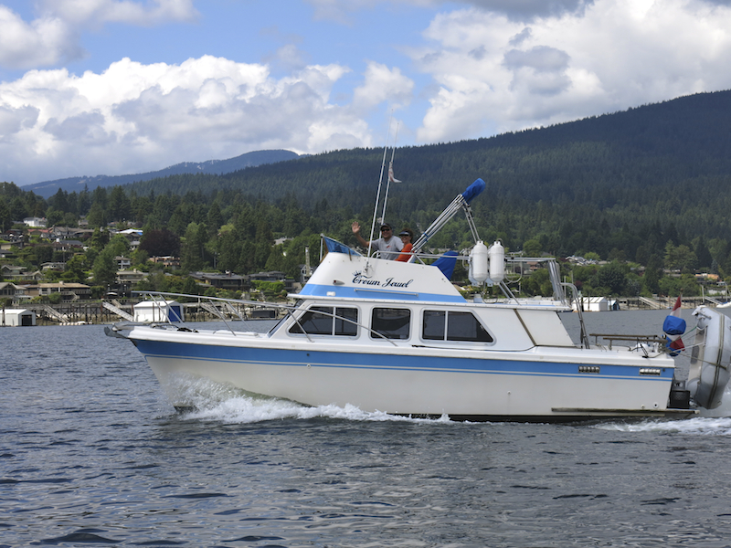
| Boating in Indian Arm - photo by Joseph Blackburn |
Indian Arm is a very popular boating destination with its calm, protected waters providing plenty of room for weekend water skiers, leisurely sailors and cabin cruisers to spend the day or night enjoying the scenery and not having to venture far from home. The next fjord over is Howe Sound, a 26 mile fjord that offers spectacular views as one drives along the sea-to-sky highway, provides a gateway for boaters to the various islands in its midst including Bowen, Keats, Gambier, Bowyer, Anvil and Hutt, and is a mecca for windsurfers thanks to the strong winds and flat head waters, where it terminates at Squamish. It's also a great haul out for the seals, a prime scuba diving area, and a sanctuary for birds in places like Christie Islets and Pam Rocks.
 |
| Seals on Hutt - photo by Junie Quiroga |
 |
| Nelson all suited up for scuba diving - photo by Junie Quiroga |
Bute Inlet & Knight Inlet are quite a bit further up the coastline off the area known as Desolation Sound and the Broughtons. This is uninhabited territory for the most part and, because they are so far away and services are few and far between, they aren't a very popular destination in spite of their tremendous scenic beauty. Fjords also don't offer many places to safely anchor (owing to almost sheer drop-offs from shore) so when you are far from home and the wind is howling this can be a bit unnerving. This is also grizzly bear country and, in summertime when the salmon are returning to spawn in their home rivers, the grizzlies are there waiting, so you have to be extra careful when you take pictures.
 |
| Grizzly bear fishing at mouth of Bute Inlet - photo by Junie Quiroga |
 |
| Jervis Inlet - photo by Junie Quiroga |
Jervis Inlet on the other hand is just a bit beyond the local scene to make it a destination and not too far away from civilization should you decide you've had enough of Mother Nature. Spectacular mountain scenery greets you as you cruise along its 48 mile length and, while it was once a heavily logged area, with massive clear cuts everywhere you looked, these have for the most part been re-planted and a new forest is now growing.
 |
| Jervis Inlet - photo by Junie Quiroga |
Waiting near the end of Jervis Inlet is a very special place called Princess Louisa Inlet, which is tucked into its own secluded corner. Now a marine park, this beautiful wilderness escape is one of the most popular cruising locations on the coast with its 120 foot high, year round waterfall known as Chatterbox Falls, the "Trappers Cabin hike" and the warm, tranquil swimming waters being the principal attractions, in addition of course to the awe inspiring views surrounding you.
 |
| Heading Up Princess Louisa Inlet to Chatterbox Falls - photo by Junie Quiroga |
 |
| Chatterbox Falls and the Marine Park dock - photo by Junie Quiroga |
 |
| Chatterbox Falls photo - by Junie Quiroga |
 |
| Trapper's Cabin - photo by Nelson Quiroga |
 |
| View of Princess Louisa Inlet from Trapper's Cabin - photo by Nelson Quiroga |
But no matter what fjord you visit or where you go in British Columbia's waterways there is always one constant in the scenery and that's the seals. Either popping up alone to check you out, or hanging with friends and family, they are always curious to see the boaters and we are always happy to see them. Doesn't matter if you are close to home or over the hills and far away, the seals are always there.
 |
| Seals on a log - photo by Junie Quiroga |


